Google Earth now includes undersea view
AN FRANCISCO, Feb. 3 (UPI) — Google, the California-based search engine giant, has added an undersea view of the world to Google Earth.
The new feature, announced Monday at the California Academy of Science in San Francisco, includes maps of the ocean bottom, photographs and videos of underwater flora and fauna and shipwreck models.
Sylvia Earle, a former chief scientist at the National Oceanographic and Atmospheric Administration, once joked that Google Earth should be called “Google Dirt,” because it omitted two-thirds of the planet’s surface. At the launch, she said that Google now provides “a fantastic new rendition of the earth.”
Google’s partners include the National Geographic Society, the Scripps Oceanographic Institution and the NOAA.
The updated Google Earth also allows viewers to go off planet with a close-up view of Mars. Another feature allows users to find out how aerial views of the earth have changed over time.
Former Vice President Al Gore demonstrated that feature, showing how the Grinnell Glacier has shrunk since 1991.
“My hope is that people around the world will use Google Earth to see for themselves the reality because of the climate crisis,” Gore said.
 Mozilla Introduce Firefox 9, with Speed and less memory improvements
  How to Start a Functioning Website Under Thirty Dollars 2021?
  The HTML5 Time Element Is Back and Better Than Ever
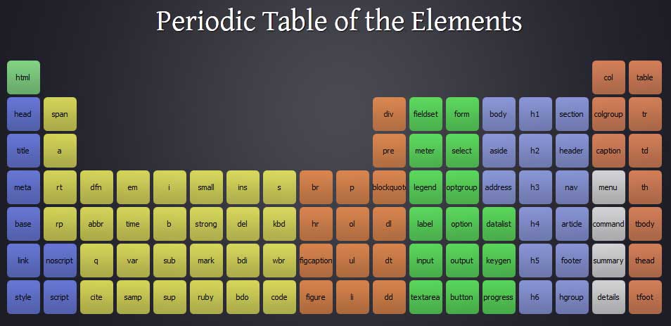
  Periodeic table of HTML5 Elements, arrange by type.